Asper(latin: Roughness)
Smarter unsealed road monitoring
Asper is a compact, low-cost road roughness system designed and manufactured by Survai Systems.
Mounted in any vehicle, it delivers fast, reliable insight into unsealed road condition — no cameras, no LiDAR, no complexity — and no driver interaction required.

Purpose-built for Regional Roads
Unsealed roads are the lifelines of regional communities — but assessing their condition is often reactive and resource-heavy. Asper provides a proactive, lightweight solution.
Data that Drives Decisions
⚠️ Flag rough sections before safety complaints arise
🛣️ Create condition maps for unsealed roads
📊 Prioritise grading and resheeting operations
How Asper works
✔️ Precision GNSS + Accelerometer Array
Asper uses a finely tuned accelerometer and high-resolution GNSS to measure surface roughness in real time — detecting vibration changes with accuracy, even on rugged and corrugated roads.
✔️ Truly Hands-Free Operation
Once installed, Asper activates automatically when the vehicle is in motion. No need for staff to press buttons or manage equipment. It just works.
✔️ Deploy Fleet-Wide
Because Asper is costed for scale, councils can install units in every works supervisor’s vehicle, enabling complete unsealed road coverage during normal operations — with no additional staff or time required.
✔️ Australian-Owned Cloud Sync
All data is synced via Australia Cloud, a secure, sovereign platform owned and operated entirely on Australian soil. Your data never leaves the country and is stored in compliance with local governance requirements.
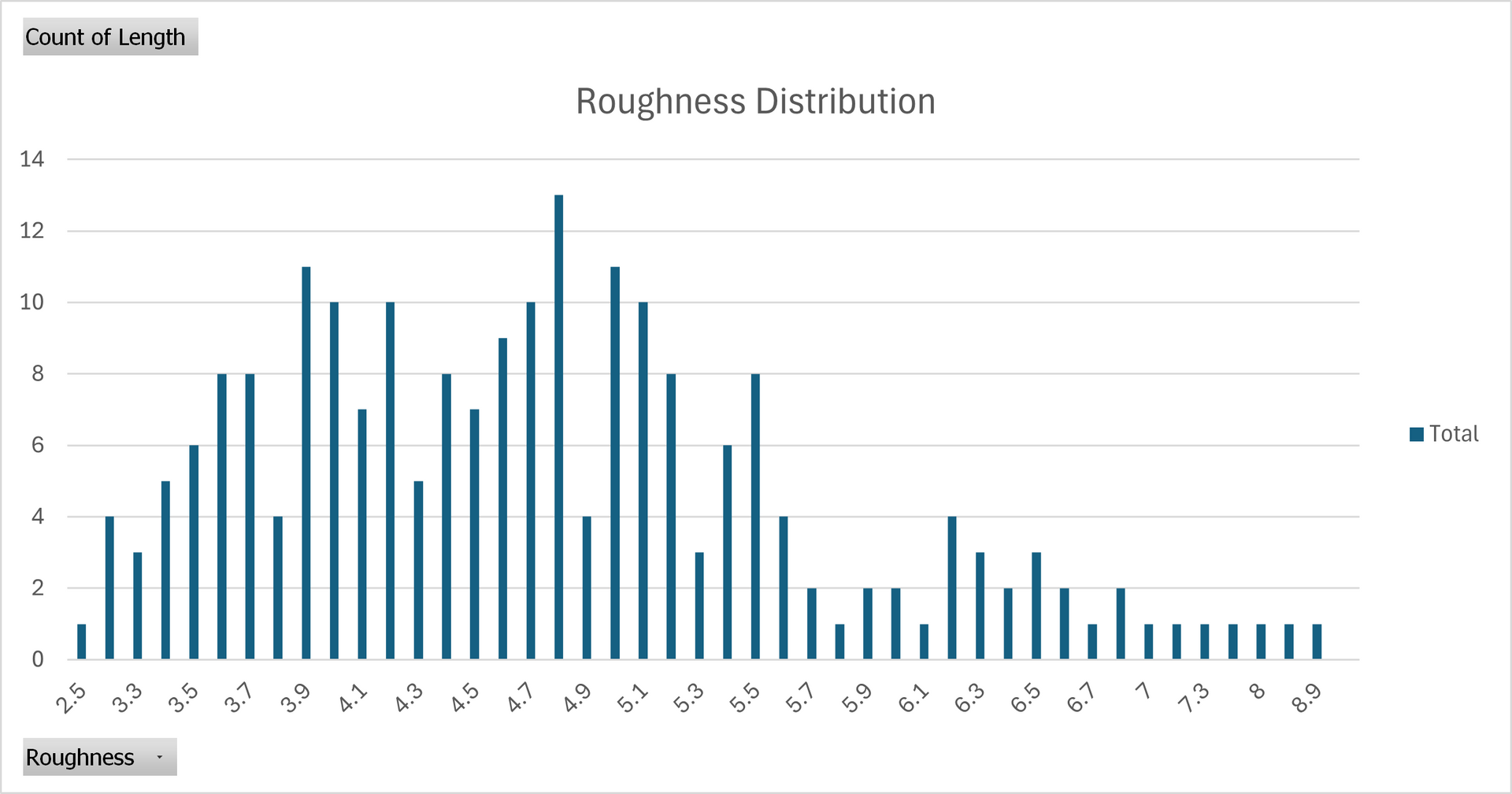
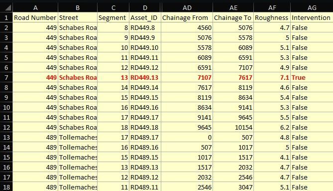
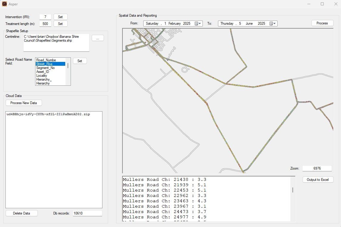
Flexible reporting
Working with our flagship software, Desktop Survai, the Asper module outputs native Excel and ESRI Shapefiles.
Road authorities can express and manipulate data with the highest degree of control.
Or, if you have specialised requirements, let us work with you to develop bespoke turn-key reporting.